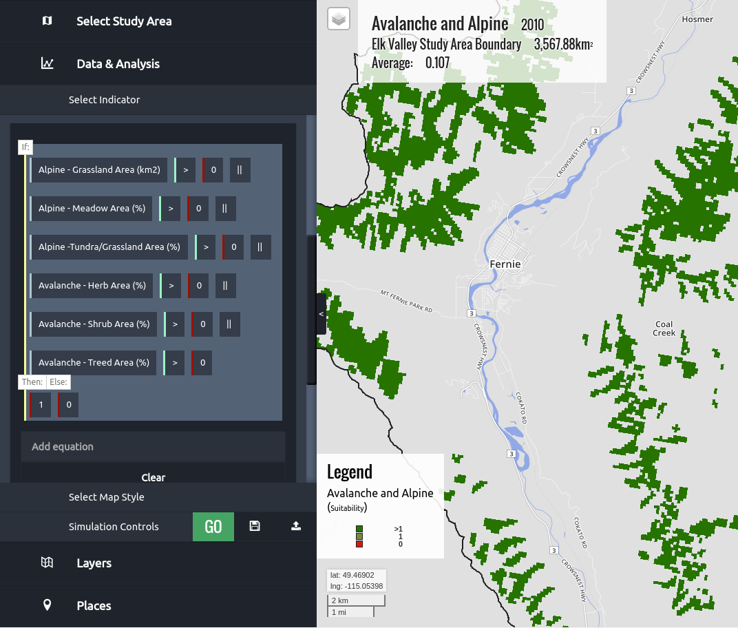
Powerful land-use simulation
The spatially explicit simulation engine maps historical and potential future changes to ecosystems, communities, and economies caused by land use, climate change, and natural disturbance. Flexibility is maximized through a web-based interface that is used to define and explore simple to complex land-use strategies.
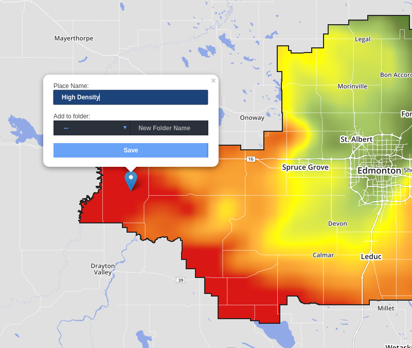
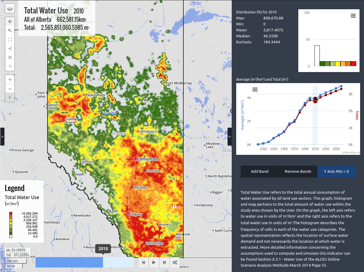
Seamless data integration
Identifying solutions to complex land use issues require the synthesis of vast quantities of data. ALCES Online facilitates synthesis through efficient tools for uploading, viewing, and analyzing spatial data. Through the use of a flexible calculator, new spatial attributes can be created by integrating diverse sets of knowledge such as natural resource and land cover inventories, traditional knowledge, ecological monitoring, census data, planning documents, and expert knowledge.
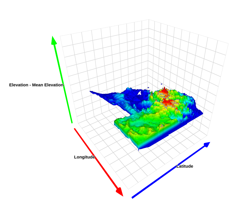
Captivating visualization tools
Use advanced graphics such as 3D maps to portray indicator performance. Visualize the consequences of land use simulations with animated maps. Explore relationships with multi-dimensional scatterplots. Tour landscapes with customizable fly-overs and up-to-date, high resolution satellite imagery.
Advanced analysis tools in the hands of planners
By providing a user-friendly approach for planners and managers to complete land use simulations and analyze spatial data, ALCES Online overcomes barriers to effective cumulative effects assessment. A background in geomatics and computer modelling is not required. Everyone from junior analysts to managers and senior planners can conduct meaningful analyses quickly and easily.